


Les Bois-Francs - Directions & map
Access and itinerary
Arrival and reception
Reception
The reception agents are there to welcome you and deliver your Center Parcs bracelet.
Contact of the reception
Reception hoursReception hours
Reception and security: 24/7
Information and reservation: from 9:00 till 19:00*
*Depending on the season
Spoken languages
- English
- French
Arrival and departure times
Arrival from 10am
You are free to arrive whenever you please and enjoy the activities and facilities: We welcome you 24/7.
Check-in from 4pm*
*For parks in the Netherlands, France and Germany you can check-in from 4pm. For parks in Belgium and Denmark you can check-in from 3pm.
Check-out before 10am**
Free your accommodation and still enjoy the activities and facilities before your departure.**See your check-out time in the Center Parcs app.
Car
Parking
Cars are not allowed inside the park, but parking is available at various rates at the entrance to the park.
Charging stations
There are 5 charging stations available in the main car park and in the car park of the La Maison du Lac hotel.
Pets
Supplement
You can of course bring your pet with you during your stay (maximum 2 pets per accommodation). At the time of your reservation, a supplement will be asked when you add your pet.
Payment in the domain
Payment methods
Credit card, pin or cash
Center Parcs wristband
Your wristband gives you access to your cottage, but also to most of the infrastructures of the domain.
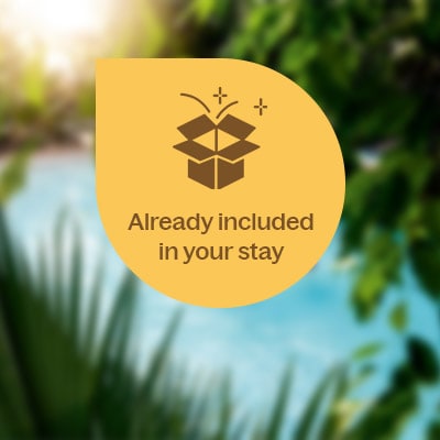
Always included in your stay
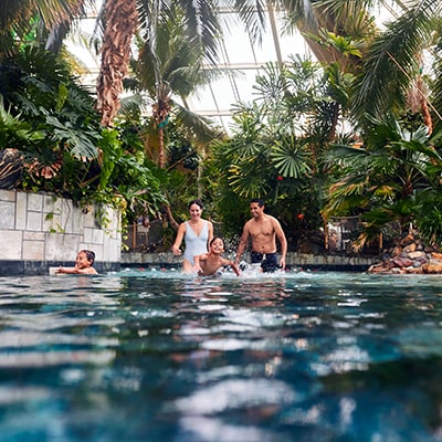
- Unlimited access to Aqua Mundo, the unique aquatic experience: indoor and outdoor waterfun all year long.
- Authentic nature experience: farms, workshops, Nature Trails etc.
- Multiple indoor and outdoor playgrounds for endless fun!
- Entertainment for everyone: kids show, live music, free games, seasonal events etc.
- Fully equipped accommodation in the heart of nature
- Free Wi-Fi & final cleaning.
Authorized swimwear for Aqua Mundo:
• Fitted swimsuits made of appropriate materials (such as lycra or equivalent fabrics).
• Swimsuits that can cover the body up to the wrists and/or ankles (with the option of an integrated fitted swim cap).
• Swim shorts above the knee and swim caps.
Consult the FAQ for more information.


Your travel companion
Once you have booked your stay, the Center Parcs application will be your companion. It will accompany you in all your preparations. Free application.
To download the app, scan the QR code with your smartphone camera.

Scan me